Open maps aim to raise awareness of walking and cycling infrastructure and its connections to green spaces, support slow travel and outdoor activities, and inspire people to see their surroundings with fresh eyes.
All these maps are available online as digital downloads. If you find them useful, please consider leaving a donation or buying a poster — it helps keep this open project and supports the creation of new maps.
London Artground Map
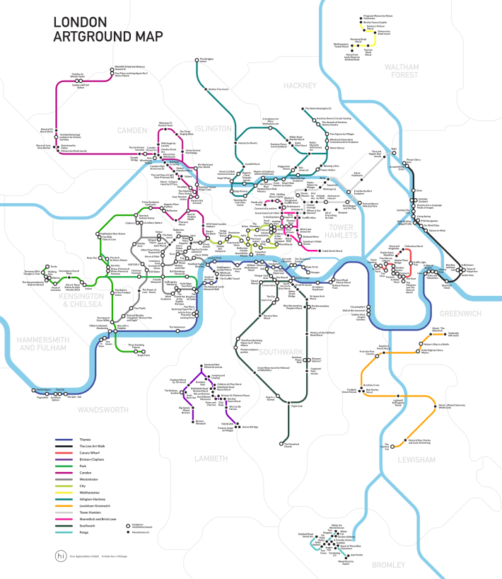
A tube-style walking map linking 300+ public artworks in and around central London
London Greenground map – 3rd edition
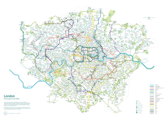
*Map of the Month at Stanfords in May 2024*
Connecting 1200 parks & open spaces with 20 green & blue lines for infinite options to explore.
Map of the British Isles and Ireland
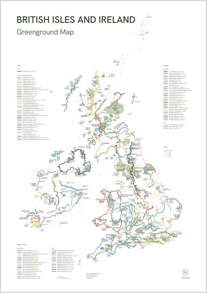
This stylised map brings together 101 national trails and long-distance walks across England & Wales, Scotland and Ireland.
Bristol Greenground Map
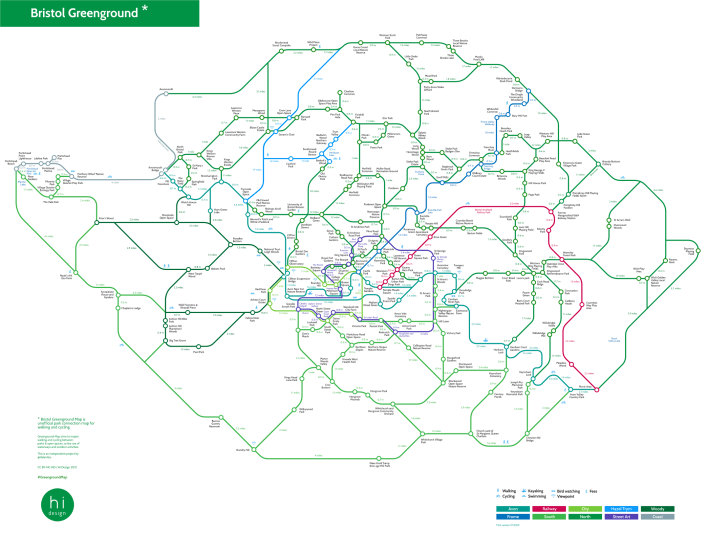
First edition map connecting 250 parks & open spaces with 10 green lines to walk and cycle in and around Bristol.
London Greenground Cycle Map
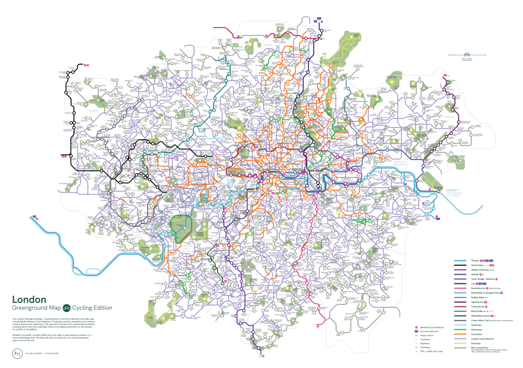
The first Greenground map connecting 1000+ parks & open spaces with London-wide cycling network.
National Parks of Europe Map
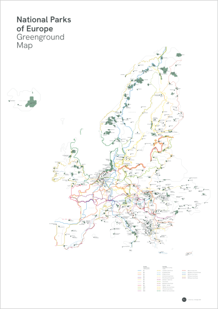
Over 400 National Parks connected with Europe’s official long distance walking and cycling routes.
Edinburgh Greenground Map
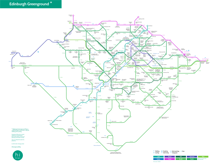
The first map connecting 220 parks & open spaces with 9 green lines to walk and cycle in and around Edinburgh.
